Ah, not so fast. Sausage, especially the legislative kind, is not so easy. When the bill as passed by both houses was sent to the President, Section 11, authorizing a new Wilderness study, was left out. Six months later (a story in itself to be told in the right place), the Act was amended to put the study back in. So that amending Act follows the first five pages.
Thursday, July 26, 2012
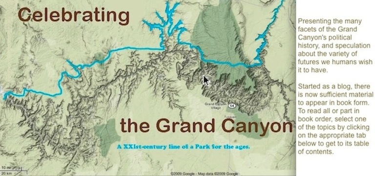
Grand Canyon National Park Enlargement Act of 1975, text
Although I am only at the beginning of the detailed history of the Act, perhaps it is useful to see where we ended up, and to have it on-line as a reference for various on-going stories in which the Act has a role. So here are the five pages of the Act as passed and signed on 3 January 1975.
Sunday, July 22, 2012
Protecting the Grand Canyon's eastern rim and the Navajo's western boundary lands
In the spirit of this blog recounting the past in order to understand what futures the Grand Canyon might face, here is one thought I had for cooperative action to protect its east side from the Paria down to the Confluence at the Little Colorado.
First step: Remember it is that entire stretch that is under threat: unregulated recreation, proposed water pipe lines, trespass on sacred land, and most presently, the heinous scheme to enrich some Phoenix whitefolk by using the weapons of mass industrial tourism to suck up investment dollars while destroying the Confluence and its nearby rim.
Second step: Remember that any action affecting the 1934 west Navajo boundary must be grounded in necessity; it must be a "required … use under the authority of the United States". I believe that thwarting the above threats, coupled with the manifest desire of United States citizens, Navajo and non-Navajo, to protect and preserve traditional Navajo and National Park System values in that entire stretch, is such a required use -- provided that the case is made fully, with examples, in public, and before & in consultation with appropriate Navajo and United States government entities and individuals.
Third step: With this requirement in hand, satisfying both the 1934 Navajo Boundary Act and the words of the Antiquities Act, recall what attorney-adviser for the Interior Field Solicitor in Santa Fe, R. C. Eaton, wrote in footnotes 5 & 6 of his 28 Aug 2003 work-product:
"The Navajo Nation Department of Justice has prepared an undated document stamped 'Draft' and titled "Preliminary Analysis of Navajo Nation Western Boundary." which Stanley M. Pollack, the Navajo National's Special Counsel for Water Rights, transmitted to Andrew F. Walch, Attorney, Environment and Natural Resources Division, United States Department of Justice, by letter dated February 28, 1997. (fn.5) In the "Preliminary Analysis of Navajo Nation Western Boundary," discussed in n.5 above, the Navajo Nation argues that the Antiquities Act authorizes the President to proclaim as a national monument only "lands owned or controlled by the Government of the United States" and that that term does not include Indian reservation lands. However, the Navajo Nation's argument is contrary to longstanding Department of the Interior interpretation and practice. See, e.g. September 26, 1978, memorandum from Associate Solicitor, Conservation and Wildlife, to Manager, Federal Antiquities Program, re: Antiquities Act Permits on Indian Lands (concluding that "lands owned or controlled by the Government of the United States" includes tribal trust lands). (fn.6)
Lets deploy that interpretation for the Navajo's, Grand Canyon's, and public's benefit by a
Fourth step: Use the Antiquities Act to proclaim, as a matter of requirement and necessity, a Grand Canyon - Navajo Rim National Monument, going from the east bank of the Colorado River up to the rim of the Grand Canyon (including the entire left river bank, and the Desert Facade and Marble Canyon's east side), and running from the Paria River junction downstream to the Little Colorado River junction. (There are already Little Colorado and Marble Canyon Navajo Tribal Parks in place.)
This GC-NR NM would be interpreted and declared as a matter of law and policy to be Navajo land in its entirety, as per the 1934 Navajo Boundary Act and given the rights and required concurrence of the Navajo under the 1975 GCNP Enlargement Act.
The GC-NR NM would be administered jointly by the Navajo Nation acting through its appropriate entities, local and tribal, and by the Secretary of the Interior acting through the administration of GCNP.
The GC-NR NM would be fully protected against all new entry, use, or action under all public land laws, and any alteration in activities carried on as of January 1, 2012 would be forbidden unless and until approved by the administering authorities after full public review, as per for instance, procedures under the 1964 Wilderness Act. All existing valid Navajo rights are protected.
Fifth step: Until the Monument proclamation is made, no actions changing the physical, social, cultural, or natural environment of the area of the GC-NR NM are allowed.
More on boundary segment B: The Navajo western boundary adjacent to the Park
PREFACE
A full title to this very, very long entry would read "THE NAVAJO WESTERN BOUNDARY ON LEFT BANK OF COLORADO RIVER AND THE NORTH BANK OF THE LITTLE COLORADO RIVER (LCR) ADJACENT TO GRAND CANYON NATIONAL PARK". A subtitle might read: An argument from history, law, ethics, and common sense. My aim is to be as comprehensive and complete as I can be in gathering and presenting the relevant materials. First, I present the foundation arguments for my conclusion that the boundary is on the riverbank, the edge of the river. The focus is on the strip of Grand Canyon east of the Colorado running from the confluence with the Little Colorado River upstream along the east bank to Nankoweap. The focus then shifts to documents and action to do particularly with Marble Canyon from Nankoweap upstream, the stretch that was included in Marble Canyon National Monument.
This matter of the Navajo Reservation boundary location is a deeply serious matter, as the current controversy over a heinous proposal to industrialize the confluence of the Colorado and the Little Colorado shows (my blog entry of 24 June 2012). Let me be honest and clear: I strongly wish, in the light (and dark) of my 50-year involvement with the Canyon, that the land & waters in question were securely, unquestionably, and unconditionally within the ownership of the people of the United States as part of Grand Canyon National Park. That it is not so I find vexing, but then, the tangled politics and law focussed on the Grand Canyon that have been generated over the past century-and-a-half are, often, exactly that: vexing, and conflict-full, and exasperating. They are, far more, deeply worth the effort, and exacting and exciting to write about.
Tuesday, July 10, 2012
Mapping Marble -- or losing them (added to 7/11/12)
As I have mentioned, NPS Land and Resources just finished working for over two years on trying to get the congressional boundary of Grand Canyon National park correct. I emphasize the adjective, because NPS does not care where the boundary really is, only where the legislative process put it or fantasized that it might be put or where some superintendent or solicitor put it. And lots of the line that they drew is pretty accurate. There are some howlers, like west of Andrus-Parashant canyons and south of Pearce Canyon. There are some interpretations I disagree with; rim locations can be tricky. However, these probably do not really matter, since much of such "judgmental" line-drawing is between the Park and the Lake Mead NRA section of the Grand Canyon - Parashant National Monument (which when we get smart again will be added to the Park anyway, and now does have some appropriate recognition and protection).
Matters are more serious, far more serious, when the Colorado is the boundary, as it is upstream from the junction with the Little Colorado and along the northern boundary of the Hualapai Reservation. In the case of the latter, then GCNP superintendent Stitt, in early 1975 just decided on his own that the Park went up the bank to the historic high water mark. A stupid move, and one contrary to the intent of the 1975 GCNP Act's Senate sponsor, Barry Goldwater. However, two obedient solicitors twisted around and claimed that the superintendent was correct, thereby insuring the Hualapai will always have a festering sore spot to inflame their passions with.
And then we get to Marble Canyon. Or more accurately, the Grand Canyon from the Paria down to the junction with the Little Colorado (LCR). Which is Marble plus what some maps call the Desert Facade--the cliffs above the river where the Canyon hugely widens, from Nankoeap to the LCR. Now, the NPS Cartographer did not have a problem with the Marble+ boundary. The 1975 Act is very clear about setting the (proposed) boundary on the east side on the rim. The fact that the Navajo have to concur and havent (and wont??) is of no matter. That the boundary is subject to "valid existing rights under the Navajo Boundary Act of 1934" is of no matter. Congress put the (proposed) boundary on the rim, and so that is where NPS puts it. Without, by the way, labelling it as "proposed". Im glad that mappers do not use the same convention when they draw highway maps; trying to drive on a (proposed) interstate could get bumpy.
And here is where the fun starts. Since the Park Service Marble+ line is not accepted by all, contested, suspect, or irrelevant to the real world, other mappers have had to make their own way. So I thought it might be entertaining to run through several maps I have and see where they place the Marble+ line.
Subscribe to:
Posts (Atom)