Thursday, February 22, 2024

Exploring how the Grand Canyon ends

draft - EXPLORING HOW THE GRAND CANYON ENDS - draft

From the Westernmost High Point, the view sweeps down and out, over the Sanup Plateau, reaching its farther edge some seven miles west where it drops 3500' in 1 1/2 - 2 miles to the water surface (of the reservoir or river, depending). That drop is a geological lesson, as shown in this piece of the 1982 edition of the stupendous, irreplaceable map done in the 1970's by Peter Huntoon and George Billingsley. (For orientation, keep track of that triangular flat in the middle at the top.)


Thursday, December 7, 2023

Grand Canyon's West Exit Landmarks

draft--LANDMARKS FOR THE WEST EXIT OF THE GRAND CANYON--draft


There is general agreement to use River Mile 277 as the length of the Grand Canyon. The actual location for RM 277 has changed, and it is appropriate to determine landmarks near the Colorado River that make it easy, topographically and geologically, to recognize an end point, the exit from the Grand Canyon. 

(Note: The boundary of Grand Canyon National Park (GCNP) in this western end includes lands that are not in the Canyon’s drainage, but flow further west into Lake Mead.) 

Fortunately, such landmarks do exist, and can be tied into the landforms that delineate the divides on the north and south sides of the river for the final drainages into the Canyon.

Sunday, November 12, 2023

HI and the Grand Canyon


COULD THE GRAND CANYON TRAIN HUMAN-HEALTHY AI?

My comments stimulated by J. Winterson’s essay (see down below) from 11/12/23 “Guardian” book section, essays on AI:


Should we not call this AI, not alternative, but inorganic-based or non-organic-based, intelligence: IBI, NOBI, …? The major point JW makes, with which I fully agree (and it is never more clear than during the present war horrors, is that our meat-based intelligence, grounded on our planet-wide male-dominance-developed world, is a failure. It is not a question of whether “we” will destroy ourselves, our world:— we DO, ARE, HAVE, destroy, destroying, destroyed. And even though we know what to do to avoid various complete destructions, we go on destroying it; making heating-up choices, for instance affecting the world’s weather systems, many of us glorying in our ability to sneer at predictions,, making up alternative fictions to allow us to continue doing just as we are, as we please. 

Saturday, October 28, 2023

Exploring the Canyon's Far West: Photos of a Walk


WALKING THE WESTERNMOST HIGH POINT
WITH PHOTOS

Below is the piece of B.L.M.'s Arizona Strip map that shows the W.H.P. and surrounding territory -- what we walked through, and what we could see from the WHP, which has the red oval around it (it is in the Canyon and the Park). The red dot northwest of the WHP is Snap Point. It marks the Park boundary, but is not in the Canyon -- the green line marks the drainage divide for the local Canyon side canyons (Parashant, Whitmore, and east).

Monday, October 23, 2023

Exploring the Grand Canyon's West End

 EXPLORING THE GRAND CANYON’S WEST END

Finally, after a number of tries, I was enabled by friends and favorable circumstances to travel to the Grand Canyon’s far west end and visit its Westernmost High Point (WHP).

The WHP is a thin,well-shaped projection (point, peninsula) that is the last piece of the Canyon’s upper rim plateaus. It is on the right here, marked WHP. Its high point is at the southern-pointing end, with the red arrow running down, and marked vividly by the red Hermit Formation below. Due west, and sitting on the big bend of the Colorado, River Mile 277 marks the defined and topographic end of the Grand Canyon. Here is a striking view of the southern piece of the WHP vividly set amidst the Hermit shale:


[The boundary of the Grand Canyon National Park (GCNP) is another story, since at about R.M. 277 (see next map), it (pink) turns north to Pearce Canyon, and then goes east to Snap Point -- both of these features are north of the Grand Canyon.] 

BACK UP; GET CONTEXT!

The great plateaus around much of the 277-mile-long Canyon provide the viewing platforms for the overwhelming majority of visitors. Here is a regional view from the always-useful AAA Indian Country map. Our trip's starting point, Flagstaff, is off the map at the lower right. 


Driving north to go over upper Marble Gorge, then along the state line, then south from Utah on unpaved roads took us down across the Arizona Strip to the Canyon's Western High Point (X). It is about 3 miles south of Snap Point, which marks GCNP's legal boundary but is not itself in the Grand Canyon. 


As a point most remote to get to, the WHP is hardly one of the normal views. Seeing into the Canyon from it required, in addition to that day’s long drive, 2-3 miles of brushy, near-wild walk south from the road. This month, October 2023, the CIMR WHP exploration expedition achieved that goal, including the photos shown in part 2, the next blog entry.* 


*CIMR group comprised these I will be ever grateful to: Hazel Clark and Tom Martin, Missy Rigg.

Sunday, September 17, 2023

WE HAVE COME FAR -- WE ARE ON THE WAY


THE GREATER GRAND CANYON’S POLITICAL HISTORY:

A PERSONAL REPRISE


With the proclamation by President Biden of Baaj Nwaavjo I’tah Kukveni National Monument on August 8, 2023, our recognition of the Grand Canyon has widened once again, this time the resulting physical and human dimensons justify a new label: Greater Grand Canyon.


Greater in part because of its further reaching out to cover its watershed; greater because in the Monument name and its Associated Tribes, it recognizes its original and continuing peoples, its future in their, and our, hands.


This essay (in 4 more parts; this is the preface) is offered as a very personal, even idiosyncratic, historical guide to our efforts at an ever widening and deepening conceptual reach that seeks to comprehend the Grand Canyon as a place, a home for its peoples, and the knowledge and experience represented and embodied in its synthesis of topography, residents, and advocates.  


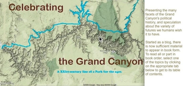
Our goal is shown in two maps (they appear in the fourth part) that embrace the designations and regard we all hold the Greater Grand Canyon in; how it encompasses its place and people.

FIRST PART: START-UPS AND MISFIRES

HERE COME NEW NEIGHBORS; SO GOES THE NEIGHBORHOOD

In American political terms, the Greater Grand Canyon started in the early 1880’s, in 1881/3, when the Hualapai Reservation was created. Simultaneously, the strange creation known as the Havasupai Reservation was declared, beginning a 90-some-year drama of broken promises, inflicted difficulties, Havasupai perseverance, and political conflict.


Almost immediately, this birthing time also produced the 1884 introduction in the U. S. Senate of John Wesley Powell’s idea for a Grand Canyon National Park, which though large in excess plateau acreage actually encompassed but a fraction of the Canyon’s 277-mile length, ignoring the wonders of its beginning and central and western regions. The Powell version of the Park settled into another 90-year mis-recognition — facetiously put, he and most visitors epitomized the Grand Canyon, the one they saw, as The Big Gully. This is was to be a site of much future conflict.